Nová správa Amnesty dokazuje, že útoky v mjanmarských štátoch Kayin a Kayah predstavujú vojnové zločiny
Amnesty International vydala 1. júna 2022 novú výskumnú správu s názvom „Náboje pršali z oblohy: Vojnové zločiny a vysídľovanie vo východnom Mjanmarsku“, v ktorej dokumentuje rozsiahle pozemné aj letecké útoky mjanmarskej armády na východe krajiny v štátoch Kayin a Kayah. Podľa organizácie ide o systematické kolektívne trestanie celých etnických skupín obyvateľstva za konanie ozbrojených skupín, ktoré už desaťročia bojujú za väčšie práva a autonómiu zmieňovaných oblastí. Krehké prímerie platné od roku 2012 sa rozpadlo po vojenskom prevrate vo februári 2021.
Výskumný tím Amnesty navštívil v marci a apríli tohto roka pohraničné oblasti oboch štátov, kde uskutočnil rozhovory s takmer 100 ľuďmi vrátane troch dezertérov z mjanmarskej armády. Podľa zistení organizácie viedli vojenské útoky na tieto oblasti k nútenému vysídleniu viac ako 150-tisíc ľudí, pričom vojaci vyplienili a vypálili do tla celé dediny.
Podľa Amnesty International predstavujú tieto útoky vojnové zločiny a pravdepodobne aj zločiny proti ľudskosti.
Rawya Rageh, konzultantka Amnesty International pre výskum a dokumentáciu postupov aktérov v krízových situáciách, uviedla, že aj keď svet od minuloročného prevratu postupne prestal venovať pozornosť dianiu v Mjanmarsku, civilná populácia tu aj naďalej čelí porušovaniu ľudských práv. „Rozsiahle a systematické vojenské útoky na civilistov a civilistky na východe Mjanmarska pravdepodobne predstavujú zločiny proti ľudskosti. Mali by sme biť na poplach: zabíjanie, rabovanie a vypaľovanie, ku ktorému aj naďalej dochádza, nesie všetky znaky kolektívneho trestania, teda taktiky, ktorú mjanmarská armáda opakovane používa proti etnickým menšinám v celej krajine.“
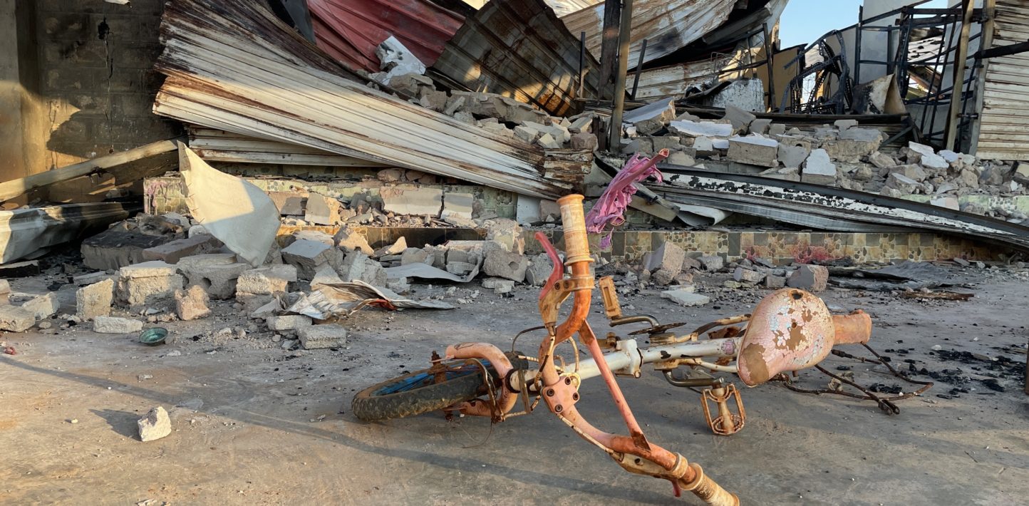
Civilné obyvateľstvo v štátoch Kayin a Kayah čelí leteckým aj pozemným útokom, pri ktorých dochádza k zraneniam, nezákonnému zabíjaniu, mučeniu a mimosúdnym popravám. Mnohých ľudí úrady svojvoľne zadržiavajú, armáda rabuje a ničí ich majetok a vypaľuje celé dediny. V dôsledku násilia, ktoré eskalovalo v období od decembra 2021 do marca 2022, zahynuli stovky civilistov a civilistiek a viac ako 150-tisíc ľudí muselo opustiť svoje domovy.
Útoky, pri ktorých armáda nerozlišuje medzi vojenskými a civilnými cieľmi, nezákonné zabíjanie civilistov a civilistiek a ďalšie porušovanie ich ľudských práv predstavuje vojnové zločiny. O zločiny proti ľudskosti môže ísť v prípadoch, keď sú takéto útoky rozsiahle a systematické, napríklad na základe etnického pôvodu, ako v štátoch Kayin a Kayah. Celú výskumnú správu si môžete prečítať na tomto odkaze.
Galéria:
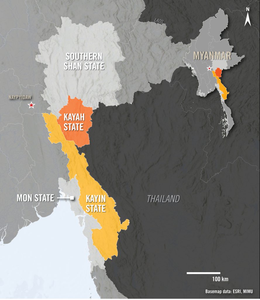
An overview map of Myanmar highlighting Kayah and Kayin States. Copyright Credit:
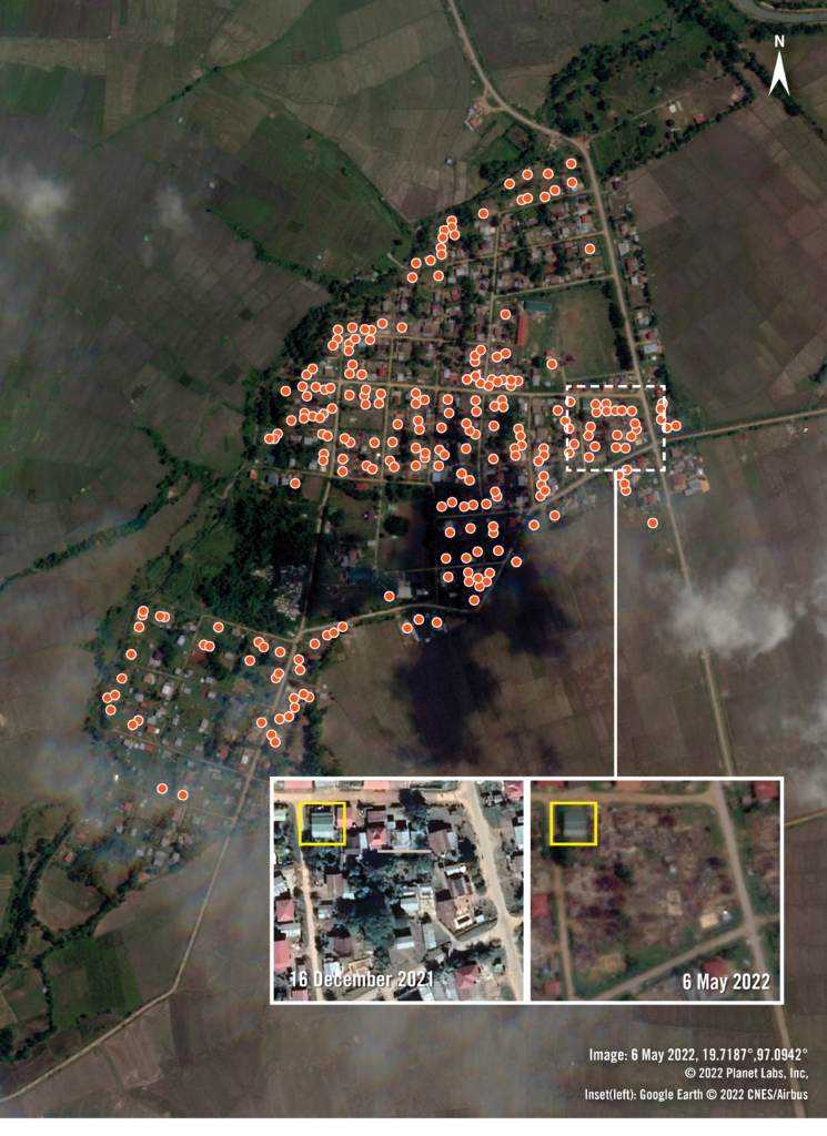
Satellite imagery from 6 May 2022 shows much of Wari Suplai village has been destroyed. An analysis of the imagery shows that almost 250 structures – indicated with orange dots – were visibly destroyed, though the number is likely higher, as smaller structures or those under trees may have been missed. Insets of a small portion of the village shows the area before and after the burnings. The only structure possibly left intact is highlighted with a yellow square for comparison.
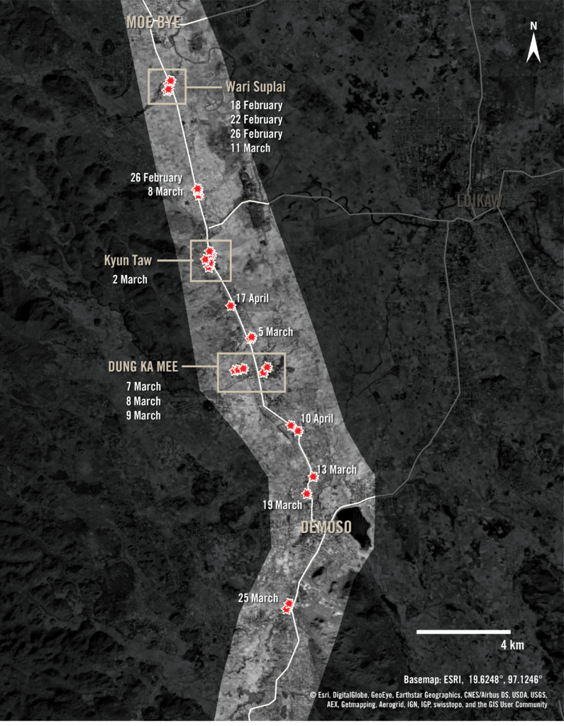
An overview of the road between Moe Bye and Demoso shows fires detected in villages by sensors on NASA satellites from mid-February to mid-April 2022. The fires appear to move sequentially from the north in Wari Suplai village to south of Demoso in February and March, with a couple villages being burned over multiple dates. In April, more fires were detected in new areas. The NASA sensors only detected larger fires, but satellite imagery shows many destroyed structures along the road, in almost every village.
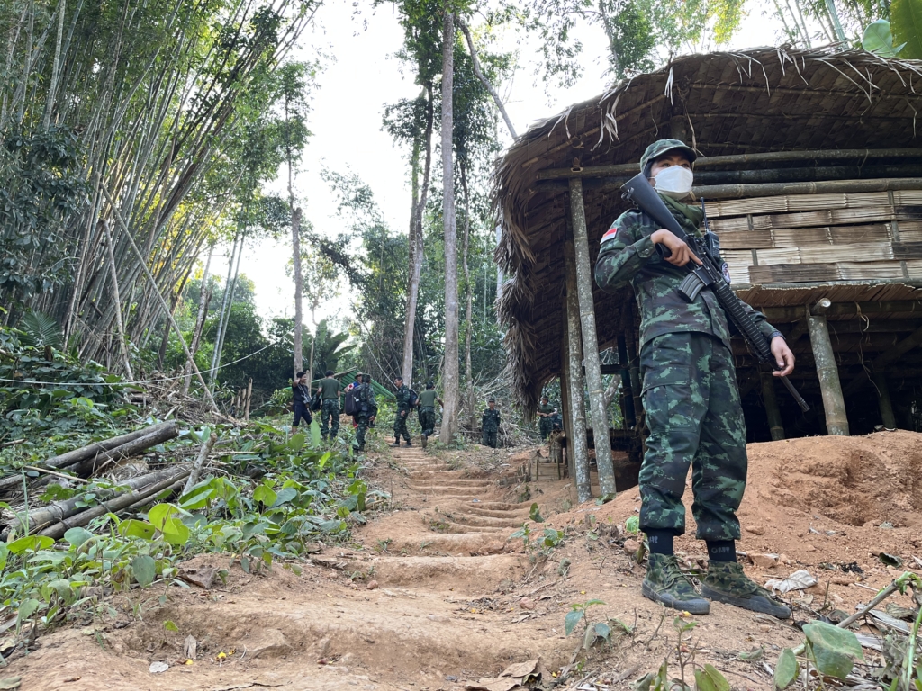
A member of the Burma People’s Liberation Army (BPLA) stands in a camp in an ethnic minority area of eastern Myanmar. The BPLA, founded by the poet and activist Maung Saungkha in April 2021, is one of many armed groups that have arisen, alongside long-standing ethnic armed organizations, following the military’s February 2021 coup.
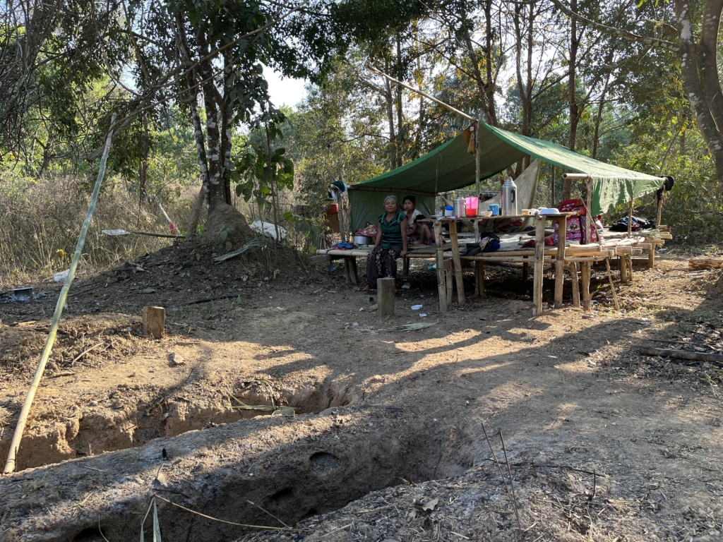
A woman, her daughter, and her two grandchildren sit in a makeshift bamboo shelter by a dirt road in Hpapun/Mutraw District, Kayin State, after fleeing their village due to Myanmar military air strikes, February 2022. The family had not received humanitarian assistance and expressed concern that the rice they brought when fleeing would run out.
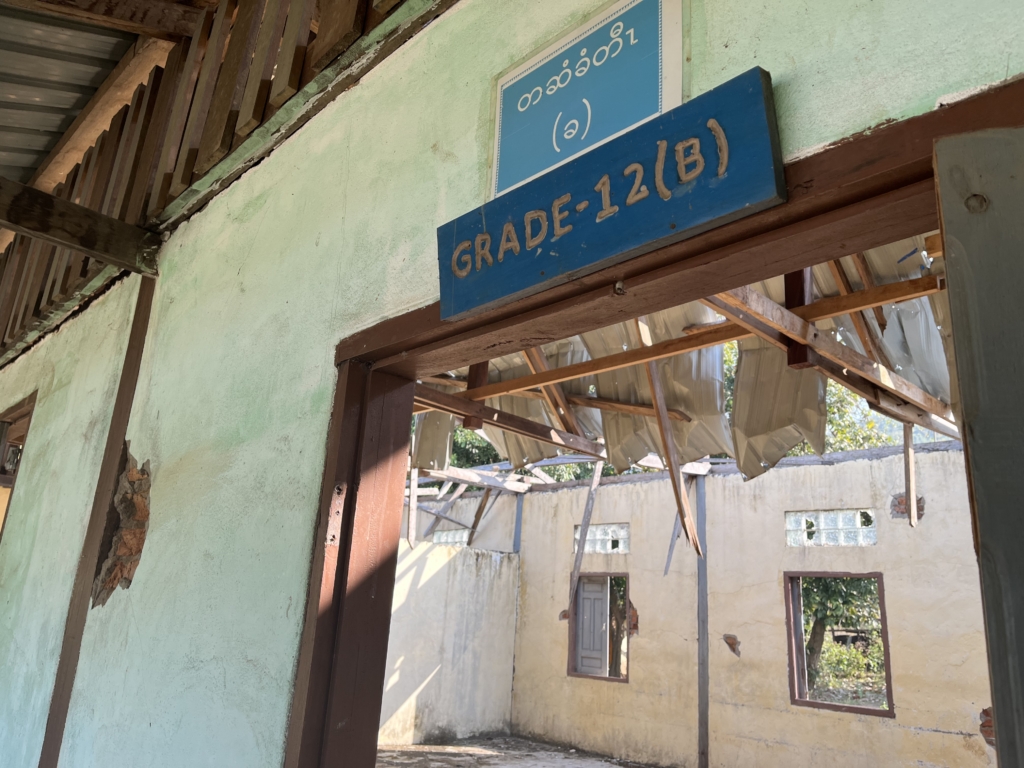
Day Bu Noh High School in Hpapun Township, Kayin State, lies in ruin after it was bombed in a March 2021 air strike by the Myanmar military, 24 February 2022. It was hit again in an air strike in March 2022.
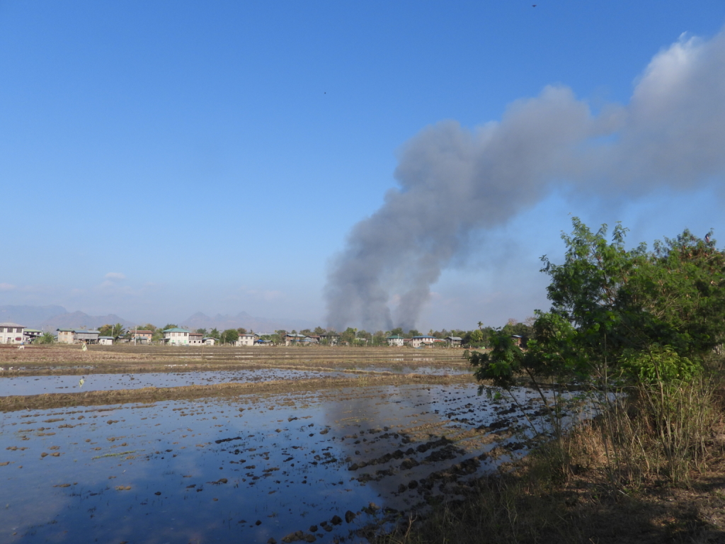
Smoke billowing from Wari Suplai village, in southern Shan State, after buildings were set on fire by the Myanmar military, 18 February 2022. Well over two thirds of the houses in the village were destroyed in February; soldiers set more alight in March.
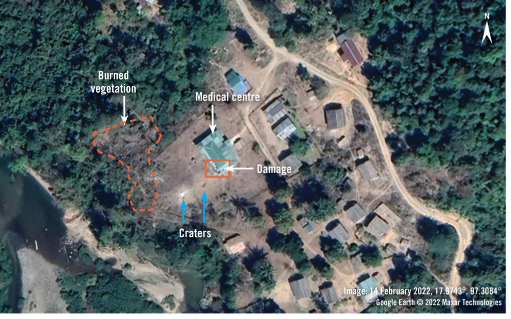
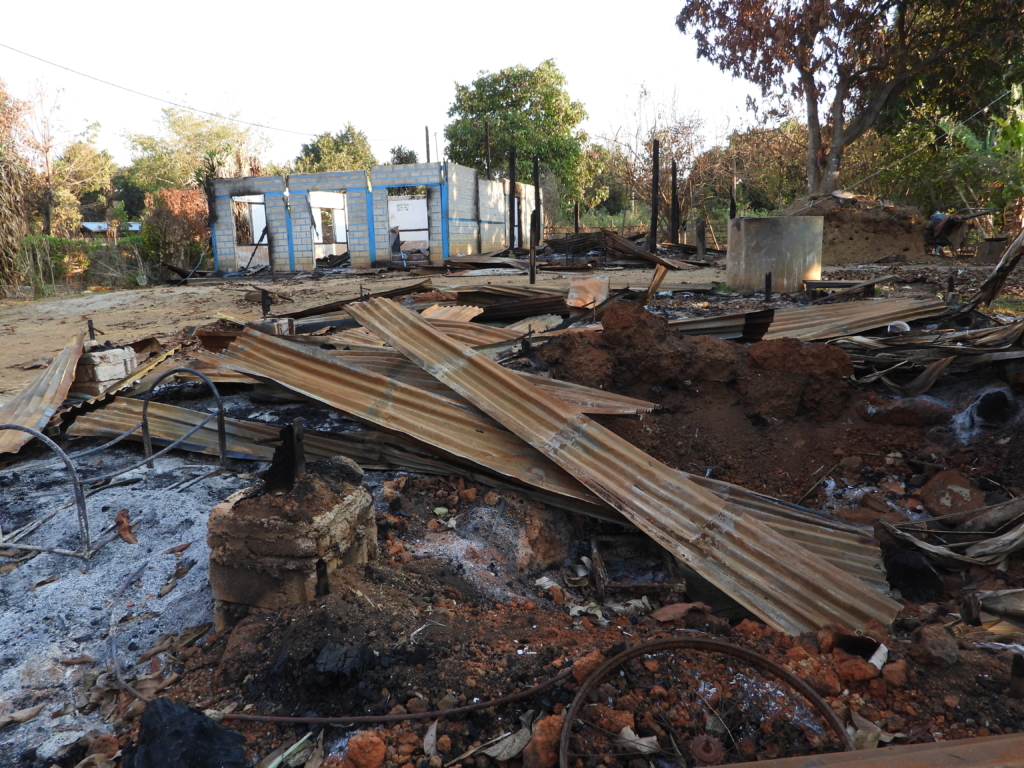
Damage seen in a village east of Loikaw, Kayah State, reportedly burned by the Myanmar military, 15 February 2022. Soldiers torched villages in several parts of Kayah State as they undertook operations in February and March 2022.
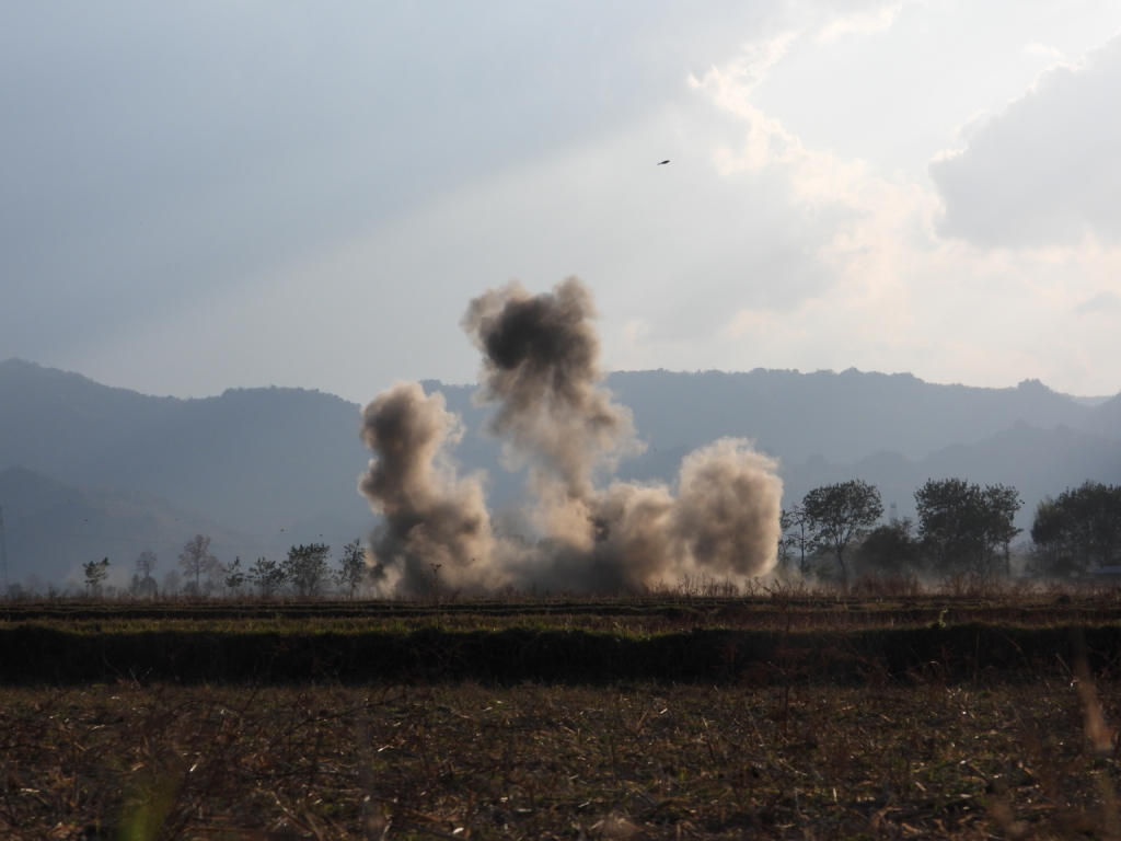
Myanmar military air strike west of Loikaw, Kayah State, seen on 17 February 2022. Many people described the military’s use of fighter jets and attack helicopters as particularly terrifying and said it was one of the primary reasons they had fled their homes.
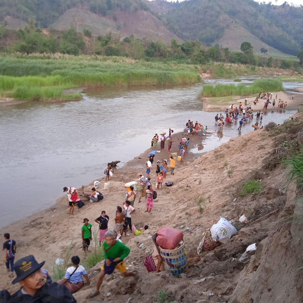
Displaced people from Myanmar walk along the Moei river on the border with Thailand after fleeing their villages following clashes between the military and rebel groups in Myawaddy on March 26, 2022.
Ⓒ MYAELATT ATHAN/AFP via Getty Images
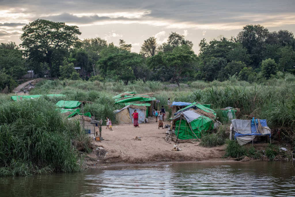
MAE SOT, THAILAND – APRIL 03: Karen and Burmese refugees who have fled fighting between the Myanmar army (Tatmadow) and insurgent groups since the February 2021 Coup by General Min Aung Hlaing, settled temporarily shelters along the Moei River Bank on the Thai-Myanmar border, in Mae Sot (500km from capital Bangkok) Thailand on April 3, 2022. They settled temporary camps right in front of the Thailand border to be able to cross to Thailand in case of Burmese soldiers raids or airstrikes.
Ⓒ Guillaume Payen/Anadolu Agency via Getty Images
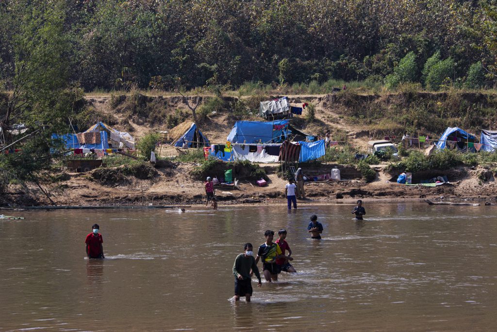
This photo taken on January 15, 2022 shows Myanmar refugees, who fled a surge in violence as the military cracks down on rebel groups, walking across the river on the Thai border as pictured from Thailand’s Mae Sot district. Ⓒ STR/AFP via Getty Images